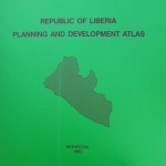
By accident – I should rather say sheer luck – I recently acquired a beautiful copy of a Planning and Development Atlas that was prepared and published by the Ministry of Planning and Economic Affairs (MPEA) in 1983. The Atlas was realized in cooperation with the German Agency for Technical Cooperation, GTZ.Cooperation, GTZ.
A friend-of-a-friend of mine who had contributed to it was at the end of 2013 going through some dusted boxes with old documents she kept in the attic and then rediscovered the precious document that had caused her and her German and Liberian colleagues so many sleepless nights in the early 1980s. Knowing my never-satisfied-hunger for old documents and records she contacted me if I would be interested in seeing it. To shorten a long story, just before Christmas she gave me the Atlas as a present – the best X-mas present I ever received.
The Atlas includes development maps with data in respect of population, resources, infrastructure etc. relevant for planning and development purposes. It is based on the censuses of 1962 and 1974. The document is impressive and not only because of its appearance – it measures 20 inch by 20 inch, is one inch thick and weighs 15 lbs! With 37 maps, 45 pages text, 68 figures and 104 tables it contains a wealth of information on Liberia in the 1960s and 1970s.
Liberia’s history of censuses
It is important to mention that the 1962 Population Census was the first national census ever held in Liberia – since 1847! – and showed a population of 1.1 million. According to the 1974 Census the country’s population stood at 1.5 million. The third and last national
census before the start of the civil war was carried out in 1984 and showed a total population of 2.1 million. The fourth National Population and Housing Census since the creation of the republic in 1847 – and the first after the end of the second civil war – was held in March 2008, revealing a population of 3.5 million.
There does not exist a comparable document to this 1983 Planning and Development Atlas, as far as I know. The Final Report of the 1984 census was never published. The manuscript and most of the data were lost during the civil war. I could only trace a 43-page Summary Report, published by the Ministry of Planning and Economic Affairs in 1987, available on the internet.
The post-war interest and support of many donor agencies made a very comprehensive Final Report of the 2008 Population and Housing Census possible. I will not elaborate on the details of this 358 page document. Noteworthy, in the Introduction of the Final Report it is mentioned that:
“(…) In addition, the civil strife in the last two decades made the situation worse by destroying national data banks. The demographic statistics from the censuses of 1962, 1974 and 1984 and socio-economic surveys conducted prior to the civil conflict are either extremely scanty or completely lost. Furthermore, most of the demographic statistics that survived the civil strife are no longer relevant to the situation on the ground mainly because of massive population displacements and/or resettlements.(…)”
Certainly, the 2008 Census has resulted in a wealth of information on the present situation in post-war Liberia, but the results are presented in a static way showing the status quo. This in itself is very comprehensible since the comparison of the census results with previous demographic and socio-economic data constitutes an exercise of a quite different nature.
However, since there is no reference in the 2008 Final Report to the 1983 Planning and Development Atlas and also in light of the quotation above I cannot rule out the possiblity that the Atlas’ existence was unknown to the Liberian authorities and the donor agencies that contributed to the 2008 Census. I would even be surprised if a copy of the Atlas exists in the country. A quick search on the internet revealed that several libraries abroad have a copy.
A detailed look at a particular map of the 1983 Atlas
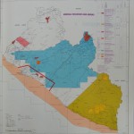
To conclude, it is interesting to highlight one particular map of the 1983 Atlas. Map 8 ‘Mineral Resources and Mining’ shows the country’s natural resources and the exploration and concession agreements granted to foreign investors and potential investors. In this respect it is interesting to read on page 23 of the Handbook Text under the caption ‘Hydrocarbon Concessions’:
“(…) A shelf of 9,266 square miles (24,000 square kilometers) which is considered potentially petroliferous has been subdivided into five blocks A, B, C, D and E from the Sierra Leone and Ivory Coast borders. Exclusive exploration rights for blocks A, B and C were awarded to the Union Carbide Petroleum Company, Chevron Oil Company and the Frontier Oil Company respectively. (…) The remaining two blocks were awarded under non-exclusive exploration rights to Chrystal Oil Company and Aracca Petroleum Corporation. (…)”
Personally, I found it a revelation that the 2011 concession agreement between Chevron and the Government of Liberia, with a price tag of US $ 10.7 billion – an absolute record in the country’s history – goes such a long way back: at least some 30 years! I learn from it that economic research may give us insights previously unknown – provided one has the relevant documents and records….. That this is certainly not always the case in Liberia will be obvious after the foregoing.
Conclusion
I hope that the foregoing may inspire Liberian government officials, parliamentarians, academic researchers, journalists and civil society organizations to make better use of existing knowledge when analyzing the present socio-economic situation in Liberia and deciding what is the best for the country. Failure to do so may easily result in – to paraphrase Graham Greene’s famous book on Liberia – a Journey without Maps


